Wednesday, July 24, 2019

Cape Wrath And Beyond.

Or as we dubbed it on the day, Cape Serenity. But more of the serenity of Cape Wrath later. 

The Calmac ferry arrived in Ullapool at a good time for us, the tide was high enough that the car deck was just about level with the street making hauling the kayak on its trolley off the ferry far easier than it could have been. A few hundred metres of hauling later and we’d found a spot for the tent just metres from the beach and tomorrow morning’s high tide. 

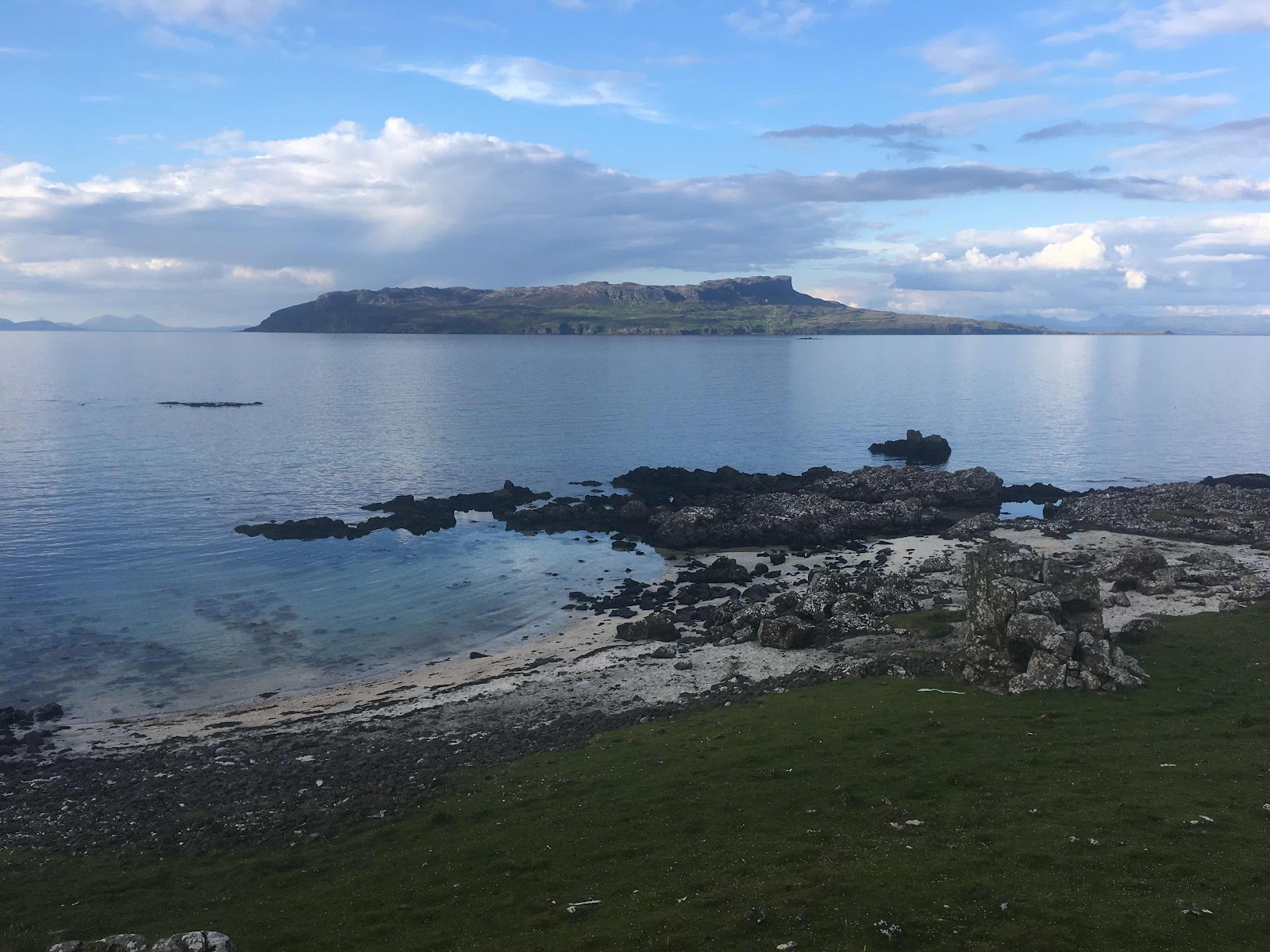
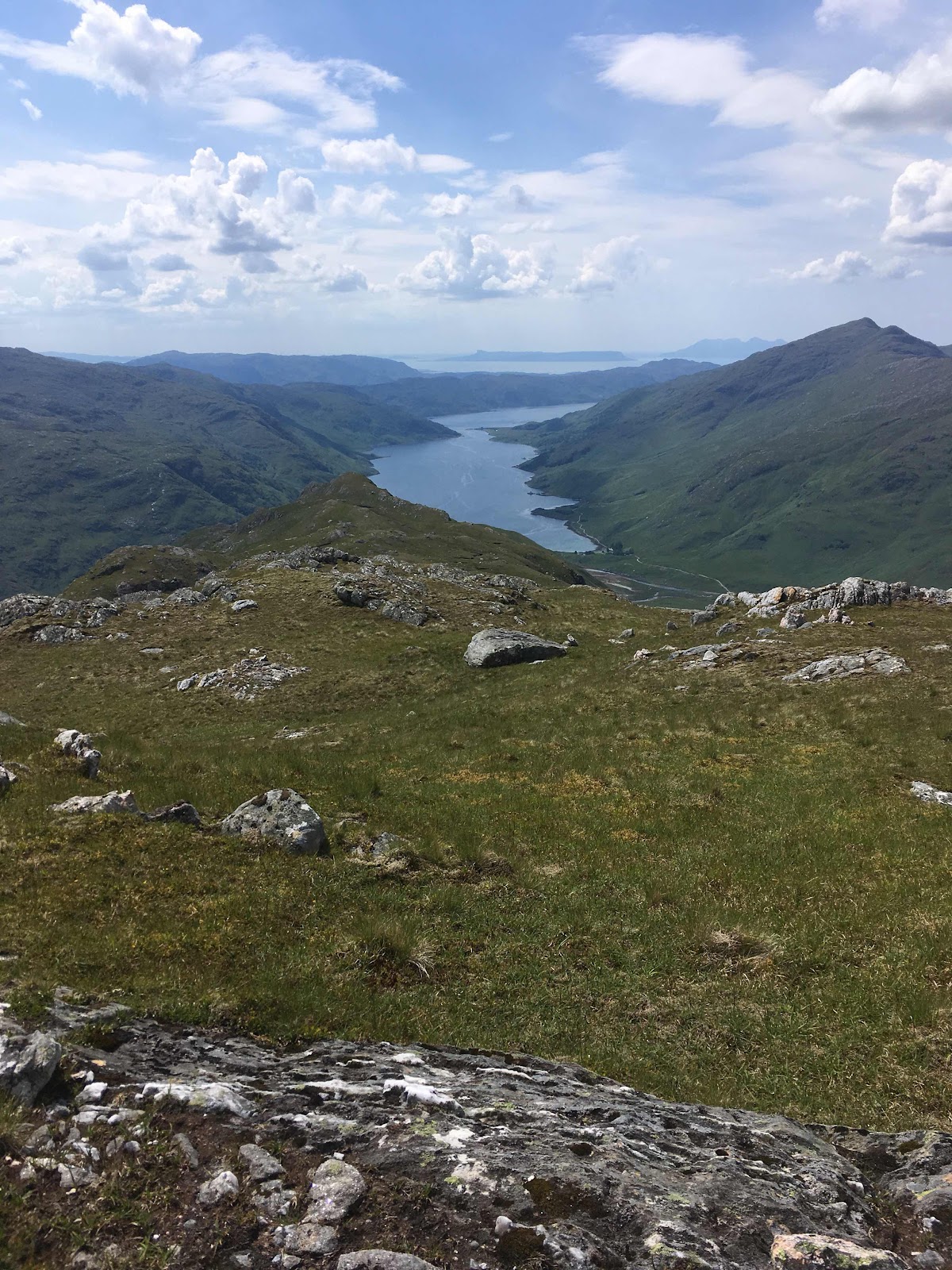
Through the Summer Isles the next morning with a light following wind then on around Rubha Coigeach crossing to Achmevich Beach for lunch. The now windless day was soft shades of translucent silvery grey. The sea sluggishly moved with a barely noticeable south westerly swell and above us the thin low cloud veiled the sun but admitted a satiny brightness that made the mirror-like sea glisten like mercury. 

On around the Point of Stoer travelling fast now with a healthy SW wind filling both sails. Just before the Point itself, The Old Man of Stoer, a sea stack well known to UK rock climbers stood tethered to the cliffs by a climbing rope. Turning into the wind around the Point it was a bit of a push against the fierce wind funneling over the headland and out through the bay to find a campsite in the shore of Culkein village. 

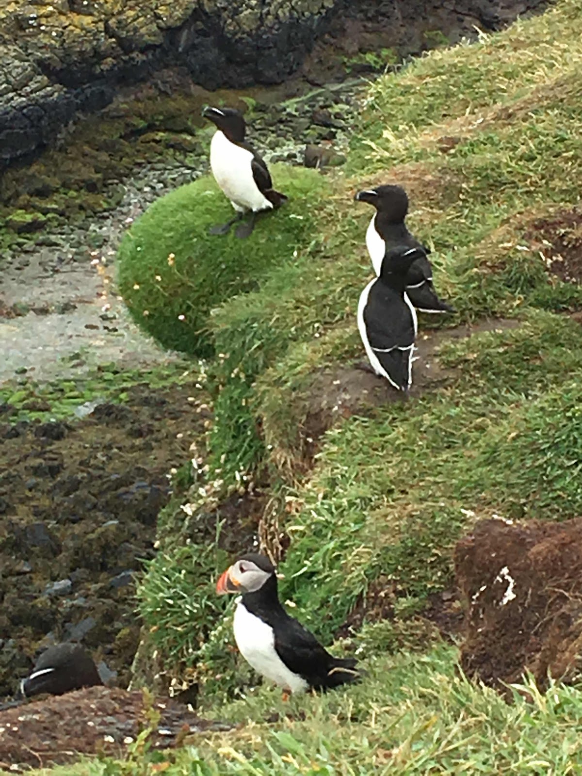
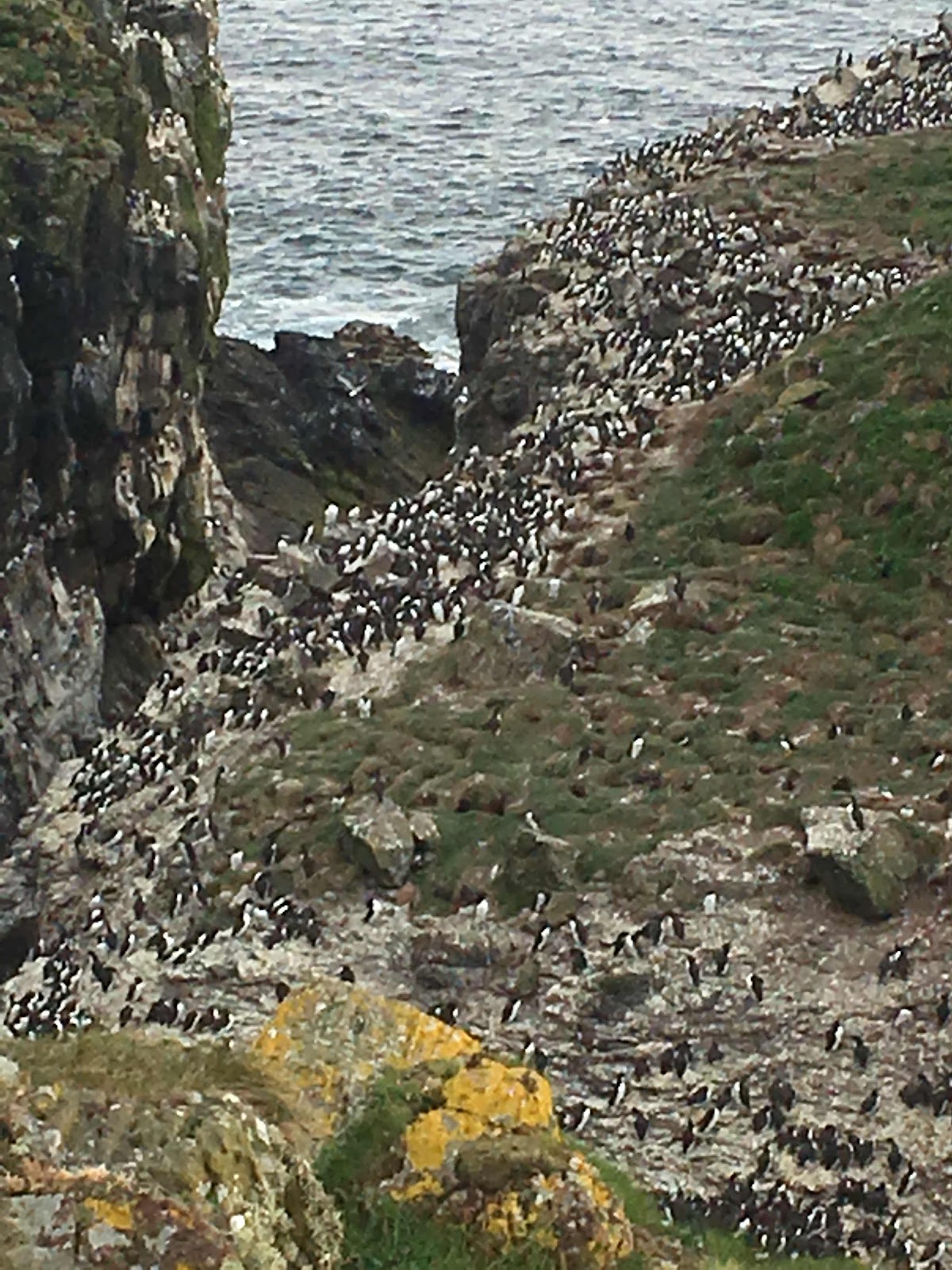
The South Westerly was still blowing the next morning so it was a very fast sail NE across the bay and then North to Handa for a cuppa and something to eat. Handa Island is leased to the Scottish Wildlife Trust. It is of particular significance for its seabirds such as guillemots, razorbills and great skuas breed in internationally significant numbers. 
 
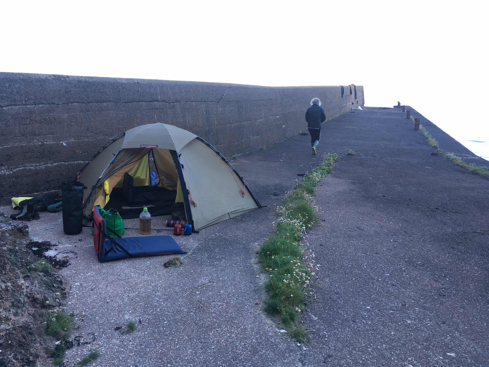
A little after 1pm and we’d set up camp at the top of the beach at Kinlochbervie and let Alan know we had arrived. Alan, a work colleague from many years ago, was joining us to round Cape Wrath and along the north coast. 


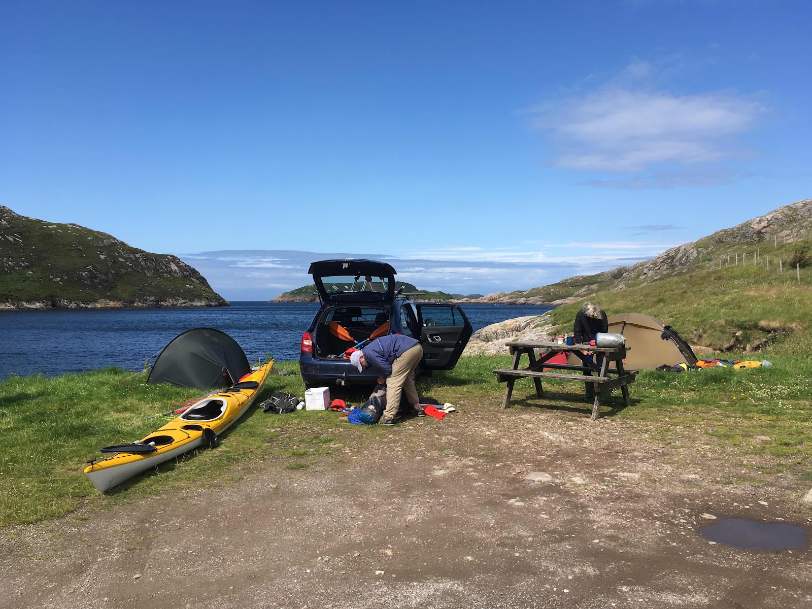
In the pub that evening we pored over maps and tidal information and decided that the conditions the next day looked good, the east going stream started about 5:30pm and we had a weakening SW wind to help us up the coast, so a sleep in and a lazy morning before heading off. 

As we left the shelter of Loch Inchard and turned north, the southerly tide and rebound made for slow and uncomfortable going for a few kilometres - hopefully not a taste of what may lay ahead. 

Sandwood Bay about 15km south of the Cape was realistically our only opportunity to land along the cliff bound and rocky shore and the benign sea conditions meant the surf would be small. Sandwood is just one of those amazing beaches, sweeping for about 3km in a graceful arc backed by dunes and low rocky hills. 

The SW wind had weakened considerably and all was pretty calm until an area of boils and a quite unruly sea just south of the Cape indicated a lot of water was still moving. Somewhere.
It was hard to tell. 
Did this mean we had our timing wrong? 
The sea calmed down closer to the Cape and by the time we arrived it was as serene as we could have hoped for. In fantastic sunshine we passed through two big arches right on the Cape, lining up photos, meandering as well as it’s possible to meander in a 5m+ double kayak back and forth revelling in the serenity of Wrath. 

On to Kearvaig and its luxurious bothy, but before we could settle and put the billy on it was a long long haul with our kayaks and gear over the long low tide length of beach of soft sand. 


Some days, and this was one of them, it seems harder work at the end of the day getting the kayak above the high water mark and camp set up than the whole day’s paddling. 

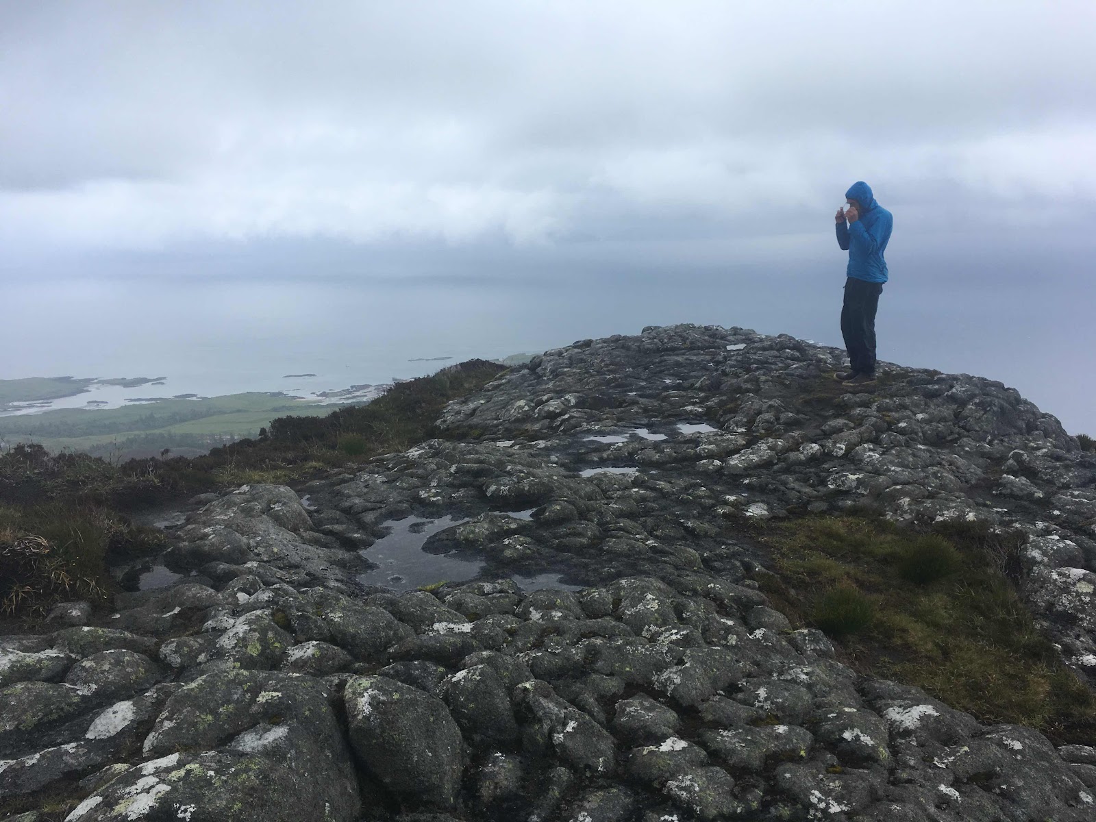
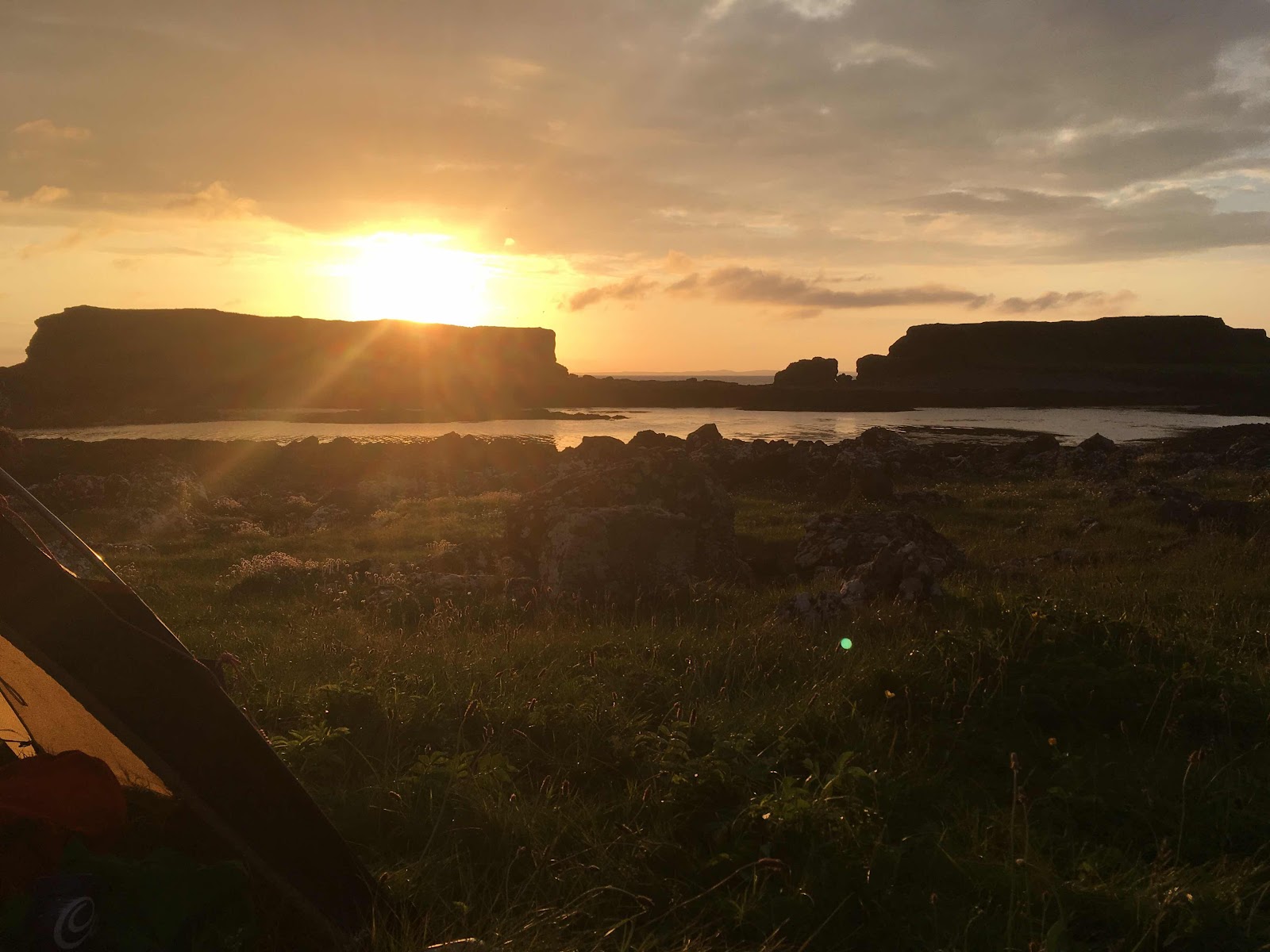
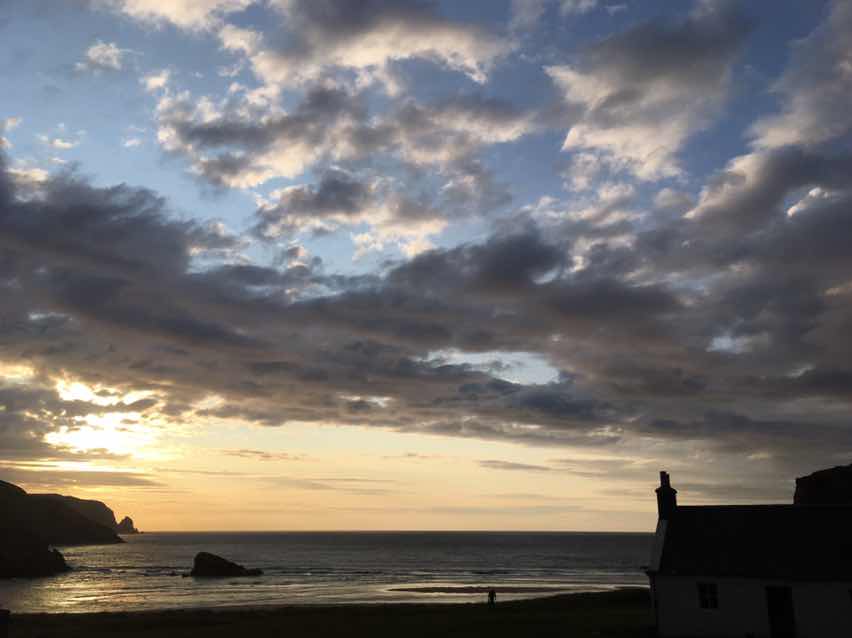
Kearvaig is one of those special places, remote wild and wonderful. You’ll probably look it up on Google Earth and get some idea of the place but either by foot, bike or kayak endeavour to get there in real life. Arriving by kayak is probably the most challenging but whatever you do, try and avoid arriving at low tide like we did. Not only is Kearvaig an amazing spot but we were treated to a calm evening of amazing light and cloud scapes. 


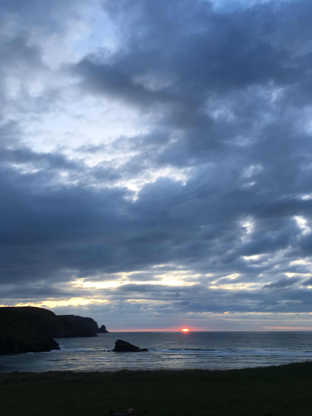
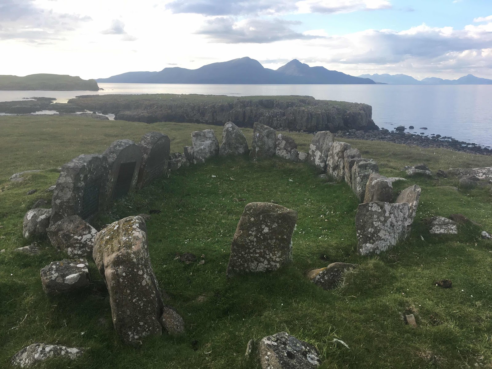
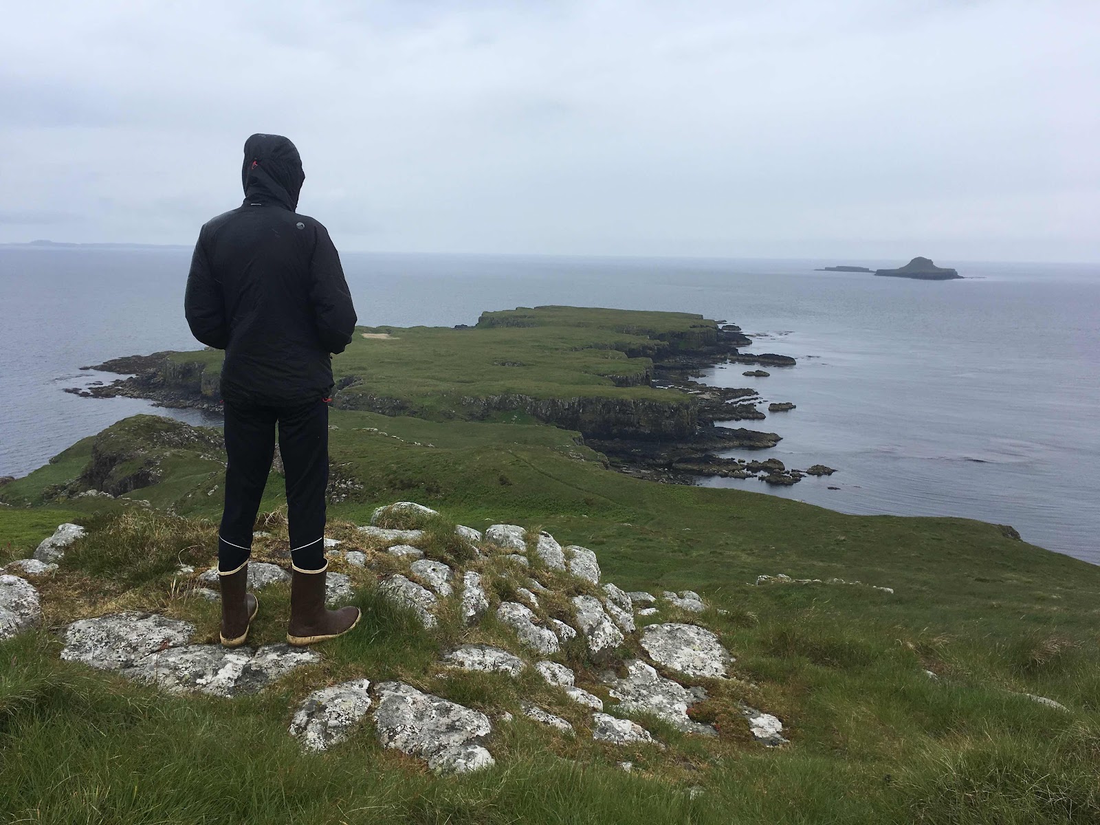
Cape Wrath in the background.

Out through the small but messy surf the next morning to pass spectacularly high cliffs abounding with puffins and guillemots. We thought the arches at Cape Wrath were impressive but this coastline just became increasingly magnificent. 

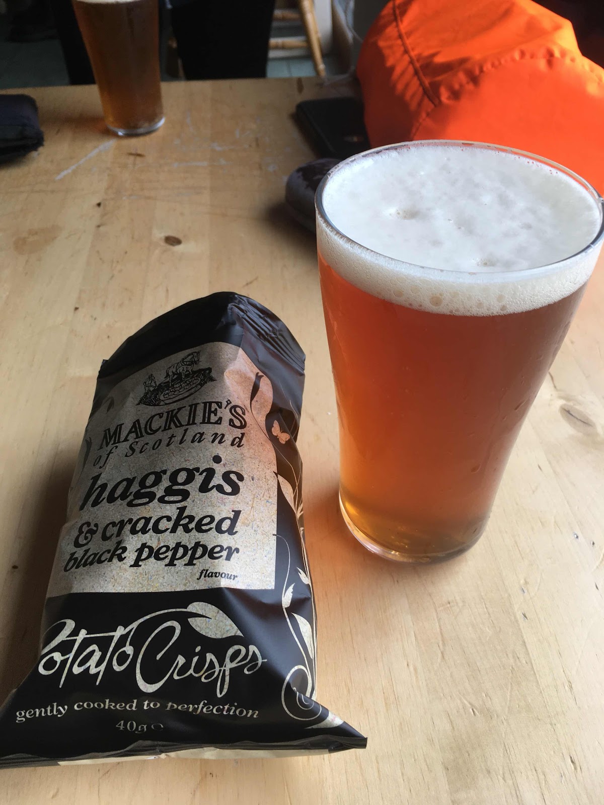
Durness was murky with drizzle but that didn’t deter the beach goers who we spotted huddling out of the rain under large beach towels. Too hard core for us - we went to the pub for a pint and counter meal still in our dripping kayaking gear. 


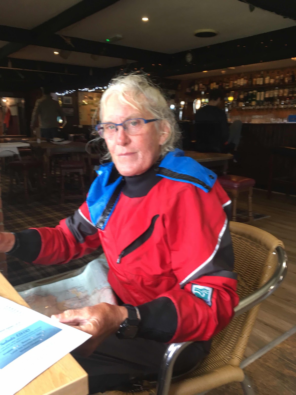
Being comfy and warm in the pub, and a second pint, inevitably meant lunch was a bit longer than it would have been if we too had huddled on the beach in the drizzle, so Rispond, a few kilometres along the coast offered a good landing and camping space. 
Rispond’s little harbour with a beautiful stone jetty and adjacent buildings were built in 1788 initially for trade in wool to Holland then salt herring and a salmon bottling plant. Now the buildings are holiday rental accommodation and a private holiday house, all in very good condition and well cared for. We certainly appreciated the flat grass on the front lawn. 

The very sheltered harbour and slip are used almost exclusively by the local lobster fisherman, who stores a week’s catch in slatted wooden crates tied floating in the water there until he heaves them all onto his ute to be shipped to Portugal.  There is no quota, the lobsters just have to be the legal size.

If you have the chance to go sea kayaking anywhere in the UK pick any section of the coastline between Cape Wrath and Thurso. Just when we thought the arches, caves, tunnels, stacks and cliffs couldn’t get any more impressive we rounded the next headland and discovered more. 

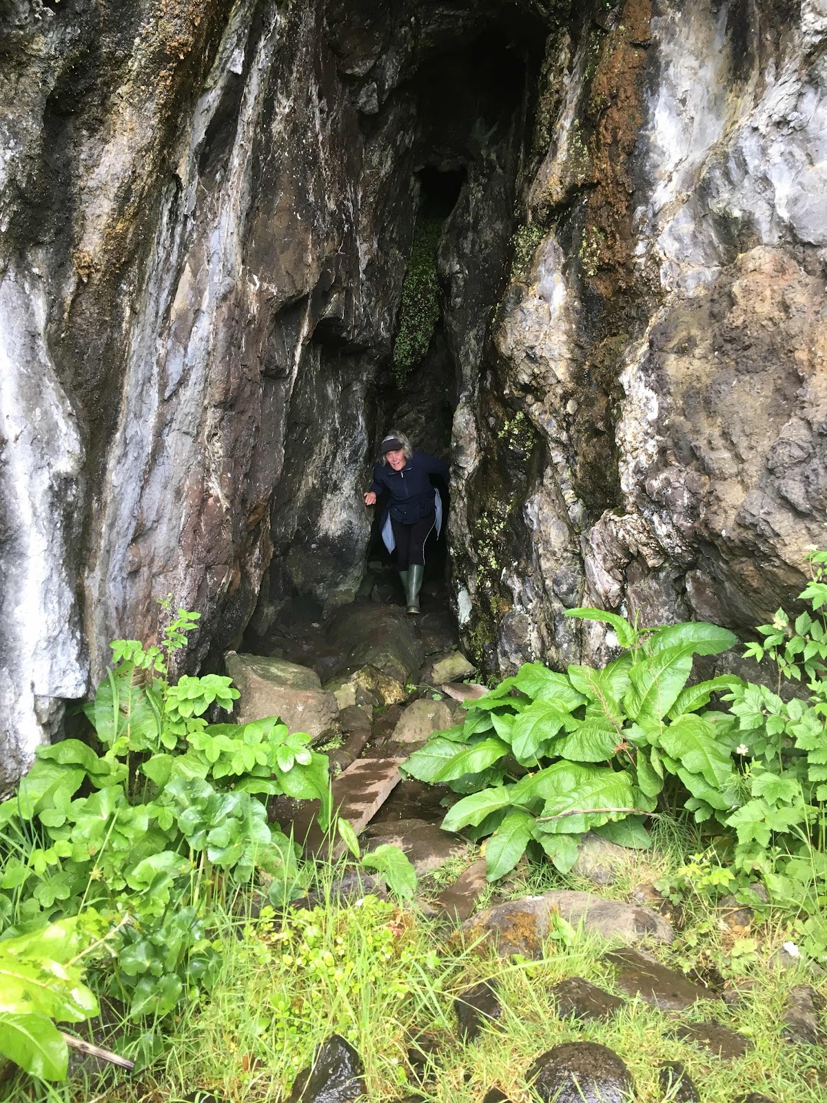
Caves we entered without a torch enveloped us in total darkness long before reaching the end, and all the while the echoey disorientating sound of the sea swishing, booming and gurgling filled our ears. One particularly spooky cave had a beach of white sand at its head, but in the semi darkness it wasn’t readily apparent what the vague whiteness ahead was, until we were aground. In the gloomy light, the long wave-smoothed purple/red rocks of the tunnels were reminiscent of the view from those tiny cameras when travelling down an oesophagus. The gurgling sea added to the effect.  

Much of the coast is easily accessible, not particularly exposed or committing and the sections between road access are short. Information on launch spots, tides and all other necessary info can be found in this excellent guide book from Pesda Press in the UK. 


Our last tidal ‘interest’ was Strathy Point, sticking some 4km out into the Pentland Firth. With low tides in the morning we were paddling most, if not all day with the east going flood so we were expecting an accelerating current around the Point but were disappointed. 

Our last night before Thurso and the end of our trip was the natural harbour at Portskerra.


The last day of paddling was as spectacular as the previous few - a myriad of caves, maze like channels between sea stacks and through arches. A nice wind too so with sails up we made good progress past Dounreay, one of the earliest nuclear power and testing sites in the UK. It is now being decommissioned which was originally scheduled to take 100 years then accelerated to take 60 years at an estimated cost of £4.3 billion (~AU$8.6 billion) The site is now surrounded by two large wind farms. 

As we rounded Holborn Head and Thurso appeared in front of us so did the wind. The same lovely sailing wind we’d had earlier in the day was now right on the nose. With 6 weeks of paddling fitness in our upper bodies we just went for it, paddling hard the final 3km to the boat ramp just at the mouth of the River Thurso. 

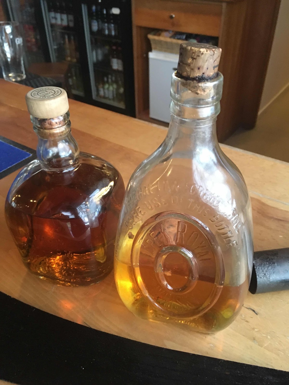
The last of the whisky was drunk to celebrate another fantastic day on the water and we wandered off into the streets of Thurso in search of a shower, food and beer. 
Not necessarily in that order. 


Wednesday, July 17, 2019

Butt of Lewis

Plod, plod, plod, the  low rocky coastline of NW Lewis slowly disappears behind us. To be replaced by more of the same around the next headland in front of us. 24kms of it. Not exactly a boring coastline but to be honest not a particularly interesting one either especially on a windless overcast day, the smooth oily sea barely undulating beneath us. A zephyr of a SE breeze moving a knot or so faster than we were just filled both sails for a while but mostly it was plod, plod, plod. 

Quite a contrast to the day before off Gallan Head where messy confused seas threw us around and slowed us down for what seemed an awfully long time. 

John and Lorna Norgrove who we’d met through a mutual friend in Tasmania (Hi Luke!) had waved us off from the beach at Carnais. 


Thank you John and Lorna for your hospitality, a comfy night in The Wheelhouse, and an insight into life on Lewis. 


Retired now, but as is often the case with active and inspiring retirees as busy as ever with a myriad of activities. Most importantly they run The Linda Norgrove Foundation https://lindanorgrovefoundation.org/ 

The foundation, dedicated to their aid worker daughter killed in Afghanistan in 2010 funds education, health and childcare initiatives for Afghan women and children. We were particularly impressed with the funding of female medical students all the way through their studies, 33 currently and they are aiming for 50. Seriously, throw them some funds. 

The plodding continued to a beach about 4kms from the Butt of Lewis where we waited for the tide to flow NE. The Butt of Lewis is one of the windiest places in the UK and the tides can run up to 6kn as the Atlantic Ocean tries to squeeze around The Butt into The Minch and then back again. By the time we were looking up at the lighthouse on the tip the overcast skies had cleared and there wasn’t a breath of wind or at slack water a trace of current. Meandering around the coastal rocks we contemplated how often the conditions are so benign to enable kayaks to get in so close. 

A day of contrasts. The NW coast of Lewis from Barvas may have been a bit tedious and uninteresting, but the NE coast to the beach at Tolsta was the opposite. Fantastic cliffs, offshore rocks, caves and arches and just screeching with with bird life.  In the bays between the rocky headlands, the waters abounded with marine mammals - we saw dolphins, Harbour porpoises and at least 6 Minke whales, one of them breaching.

The thought of a beer, the first since Castlebay, as Stornaway loomed ahead of us had pushed us on around Tolsta Point to land at 6:30, a bit later than our usual knock off time. At least our feet were on dry land, a pretty good signifier that a day on the water has been a 100% successful, but camping was limited to the dry, deep loose beach sand. Just the worst! And really not what we needed to cope with at the end of a long day. 

The incongruous Tolsta pier at the end of the beach came to the rescue with smooth, flat and having been in the sun all day, warm concrete. The pier built in 1894 against the advice of local fisherman had finally proved useful, as a campsite. Cue a rave for freestanding tents. 


Stornaway!

The ramp we’d hoped to use to wheel the kayak ashore for the ferry didn’t exist so we tied up in the marina and headed for the homely Heb Hostel. With bodies hosed clean by glorious long hot showers and smelly thermals going around in the wash it was beer o’clock at the Crown, the only pub in town with hand pumps. 


Pedal powered Harris Tweed loom. 

High tide and on its trolley we hauled the kayak out into the street and around to the Calmac terminal for the ferry the next day.


Monday, July 8, 2019

Castlebay and The Vatersay Boys

The two very windy days camped on our ‘nae midges’ knoll on the NE tip of Eriskay made us very appreciative of our sturdy, seemingly bombproof, little tent. 

Eventually the wind dropped and veered NW so in theory an easy 25km downwind run to Castlebay. We left mid afternoon and shot down the Eastern shore of Eriskay but crossing the Sound of Barra even though only a couple of kilometres was full on with the wind and a steep choppy sea right on the beam. There was no way we were tackling that wind all the way to Castlebay so ducked into the channel between Gighay and Hellisay to find a camp for the night.

Another plod into a fierce headwind the next morning and we finally reached Castlebay. A scenic little sheltered harbour dominated by Kisimul Castle standing proudly on a skerrie smack bang in the middle of the bay. It was busy too with the daily Cal Mac ferry from Oban, the tall ship ‘Lady of Avenor’ running evening cruises and visiting yachts of all shapes and sizes. 


Between the late 1800s and the early 1900s Castlebay was at the centre of the herring boom. At it’s height the shoreline was a hive of activity with thousands of men working on the boats, the herring girls in the gutting sheds as well as coopers and other associated trades. 


We tied up to a pontoon in the marina and found a lovely sheltered grassy spot for the tent nearby, just above the high tide mark. With the marina showers and washing machines just metres away we rapidly sorted our smelly and salt encrusted bodies and clothing and wandered in to Castlebay. Within a matter of hours we were warned that the harbour master was a grumpy bas.…erh, shall we say, person and that he may object to us camping on the foreshore near the marina. Later, back at the tent sure enough there he was, busying himself around the marina and the incoming yachts. Inevitability he came over with a “helloo”.  His only concern was our kayak tied up at a quiet end of one of the pontoons. Once we explained we were moving it ashore at high tide he was cool even mentioning what a sheltered spot we had for the tent. 

A little while later the tide app told me there was another 1.2m of water to come in. Mmmm, that’s extremely close, if not above groundsheet level. We looked with concern at the seaweed tangled through the grassy patch we were camped on. Perhaps it wasn’t storm tossed seaweed, perhaps it was the springs high tide mark and the grumpy harbour master didn’t have to move us on as he knew the tide would do it in a hour or so. 

There was some discussion about membership of the Underwater Camping Club, of which I’m a full member. Ask me how to join, it’s quite easy.

We’re going to be here a couple of days and the tides are getting bigger so membership of the UWCC seemed a certainty, until I rechecked the tide app. This time it had updated to the correct time and told me there was only further 30cm of water to the tide height of 4.2m. The next couple of days the tide is 4.4m, but still heaps of freeboard.

Given the forecast for the next few days we were uncertain whether to stock up on food and carry on knowing we’d probably not make much progress up the West Coast of Barra and beyond or rest up and hope for the predominant Westerlies to abate. This decision was made for us having spotted an unassuming little poster advertising a gig by The Vatersay Boys at Vatersay Hall on Friday. Decision made! Tickets bought! 

Some boat maintenance, a walk up Heabhal at 383m the highest point on Barra, Castlebay Heritage Centre, wifi at the Community Hub, reading, eating and shopping for a weeks food filled Weds and Thursday.


Friday and all stocked up with food, we set off into the low cloud, drizzle and stiff Westerly aiming to camp on the West Coast of Vatersay. It was a bit of a plod across then straight into the wind so the first beach on the south Coast was too tempting to pass by. 

With the tent out of the wind in the lee of the gable end of a ruined house we were within walking distance of the Hall for The Vatersay Boys gig in the evening. 

An impressive drum kit, a piano accordion, a button accordion and bagpipes make a lot of noise, more than enough to fill the Hall. It was a sell out evening and obviously very popular with the locals whose ages ranged across four generations. The young teenage girls dressed in night club finery were first on the dance floor, the teenage boys weren’t far behind. For the best part of three hours the teenagers dominated the floor as the Boys pumped out one tune after another.

What a fantastic night!

Monday, July 1, 2019

Outer Hebrides.

We really could not have scored a better day for crossing from Milovaig on Skye to the isle of Ronay, NE of Benbecula. The distance is almost exactly the same as Banks Strait between Musselroe in NE Tasmania and Clarke Island in The Furneaux Group, similar tidal flows too. We’ve crossed Banks Strait a good few times but there was a tad more nervousness for this crossing. Unfamiliar waters maybe but perfect weather forecasts. The Windy app was giving us variable winds from the SE of up to 8knots, the Inshore Waters forecast was giving us variable winds too, from the NE, Force 3 or 4. Either would do very nicely thank you. Both forecasts meant with the wind behind us we’d be sailing, but if we had a choice the Inshore Waters would come first as we’d be sailing even faster. The wind strength and direction might be uncertain but what was certain, given the general situation, was a hot sunny day.


The evening before we left Lynne got chatting with a fella at the Milovaig jetty. Once she mentioned we were kayaking he insisted on coming over to inspect our boat and chat all things kayaking as it turned out he had been sea kayaking for 30 years including a solo circumnavigation of the UK in 1994. He was out in his inflatable the next morning fishing and gave us a wave as we headed offshore. 

As it turned out neither forecast was quite right, the wind was NE as the Inshore Forecast predicted but Windy picked the strength, just enough to fill both sails and give us a little boost. We’d left about 10am which according to the Tidal Atlas would put us roughly in the middle of the crossing at slack water between the Southerly ebb and the Northerly flood. As it turned out we didn’t come across any perceptible tidal flow, and our track followed the straight line route on the GPS very closely simply by aiming for a prominent hill on North Uist all the way across. 

Without a cloud in the sky we paddled meditatively on without a care in the world. We could feel by the lessened load on our paddle blades that the sails were helping us along just nicely. 

Far to south we spotted a large freighter, heading north. Knowing we were crossing shipping separation lanes I repeated the mantra learnt as a kid crossing the road, “Look right, look left, look right again”, adding a contemporary “Then paddle like hell!”

A few checks of its position over the next few minutes confirmed the ship was going to pass well ahead of us.

A little while later Lynne spotted another, heading south. This one too was going to pass ahead of us, but much closer than the previous ship. We headed more northerly and slowed down to increase the distance between us. It rumbled across our bows about 1.5km ahead of us. 

Back on our original course we paddled on until ‘smoko’ time, about 2 1/2 hours from leaving the beach in Skye. We were ready for a break and something to eat, the GPS told us we had about 5km to go and while sitting there relaxing and eating the light North Easterly was pushing us along at about 4kph. 

I had checked out the east coast of Benbecula and the adjacent coastline on Google Earth for landing opportunities at some point. The continuous rocky shoreline seemed very uninviting with few if any beaches of any sort. I thought it can’t be that bad, there’ll always be something. Well I was wrong,  it was worse. 

Eventually, at about 1:30 we found a bouldery beach that enabled us to clamber out and pull the bow of the boat up on the rocks.  We stretched our legs and had a pee, and were tempted to linger longer and have a cup of coffee, but having just had a break we thought we’d carry on a bit further. Which we did. A bit further, and a bit further and further still as every headland, every corner, every bay just revealed more uninviting rocky coastline. There were a few pebbly beaches but once close they were all guarded by seaweed covered rock shelves or boulder fields. Finally, a couple of hours later, and by now really needing a coffee, food and a rest, we found a bouldery beach with no offshore rocks, just seaweed. I pulled the rudder up and we glided into the seaweed. 

And stopped dead. 

It was so thick and the water too deep we couldn’t even get out, let alone pull our the boat through it to the beach, 5m away. 

There was nothing for it, out came the standby food that lives behind my seat, a tin of baked beans and a tin of rice cream.

The map showed a sandy beach on the Southern side of a small island, so we navigated the maze of skerries only to find a mass of boulders.

Onward, but by now time was getting on and we were looking not just for a rocky beach to pull the bow up but a proper landing place where we could get the heavily laden boat right out of the water and camp. This was not looking too hopeful until eventually in the distance we spotted the Petersport jetty/boat ramp and on a knoll above the clutter of ropes, buoys and pots was a lovely spot for the tent. 

After nearly 50km with only one break ashore of 15-20mins the end of day dram of Jura malt never tasted so good. 


Heading south the next day into 15kn Southerlies we landed in the SE facing bay of Bàgh Uisinis with its comfy bothy looked after by the Mountain Bothies Association. By the time we were back on the water the wind had all but dropped away so we made good time to the entrance of Lochboisdale. It was well past lunch and we were looking for a landing spot, hah! We discussed heading into Lochboisdale itself knowing there would be a boat ramp/jetty but the extra few kms in, then back out again wasn’t attractive.  

Luckily on the southern shore alongside a steep rocky gulch we were able to climb straight out of our cockpits up onto the rocks without the need to beach the kayak at all.

The map showed a number of small sandy beaches on the Northern shore of Eriskay, and this time it did not let us down. We pulled ashore just on high tide on peerless white sand and just meters away a perfect spot for the tent on beautifully flat machair. 

“Nae midges” I shouted over the roar of the wind and the buffeting, flapping tent. It’s become a bit of a catch phrase on this trip as when we can we’ll always camp on a high point so as to catch the slightest of breeze to help keep the ‘wee beasties’ at bay. It also has advantage of panoramic views. 

So far this has worked very well with only a couple of mornings of midge terror in three weeks paddling. 

Even before we’d landed at our perfect white sand beach I’d realised we were only a couple of kms from the ‘Am Politician’, the Eriskay pub. The thought of a pint or two and a pub meal only half an hour’s walk away.…well.

For smelly, salt encrusted, hungry and thirsty sea kayakers the pub would at least sort out the two most important of the four. 

The SS Politician is the name of the vessel that went aground off Eriskay in 1941 carrying a huge cargo of malt whisky. The locals of course thought this manna from heaven was wonderful; the Police and Excise officials less so. The story of the SS Politician and the horde of whisky is told by the book and film “Whisky Galore”.


Whisky bottles from the ship SS Politician, the bottle on the right still containing the original whisky. 

With the pub wifi enabling contact with the outside world I had confidently messaged a mate near Fort William that we’d be in Castlebay the next day. Only 25 kms away and Castlebay would sort out the smelly and salt encrusted parts of us that the pub couldn’t. But that was before we checked the weather.  Ah, right, maybe I spoke too soon. 

The Inshore Forecast predicted W or SW 5 or 6 and Windy’s forecast was a mass of the angry looking hues that indicate without any further detail that little, if any, progress was going to be made the next day. The general situation with a low passing close to the NW of us confirmed the predicted winds. 

We’re always hopeful, maybe on the lee side of the islands we’ll have enough shelter to make more than head banging progress into the wind, maybe it’ll just blow for a few hours and then drop out. The night brought thunder and lightning, torrential rain and gusts strong enough for me to check that our dry suits, life jackets and spray decks stacked neatly outside the tent doors weren’t in danger of blowing away. They weren’t, but “Nae midges” I shouted into the night over our gale swept knoll. 

The alarm at 6 went unheeded apart from to turn over and go back to sleep. At least the morning, if not the rest of the day in the tent, plenty of time to satiate Lynne’s new found Archers addiction with the Sunday omnibus edition on Radio 4.


Our campsite on the NE tip of Eriskay. 

Sunday went quickly even though we were pinned down by South Westerly gales. Reading, knitting, Radio 4, snoozing and being largely a dry day out and about exploring the nearby coastline. During the night the wind veered North Westerly and is still blowing as strong as ever. With no phone and barely any VHF reception for a forecast we may have to go to the Am Politician again for their wifi. 

Thursday, June 27, 2019

Your Kayak Is Floating Away

We’d done a big shop so the kayak was loaded up with food for a week or more, the new rudder blade had been fitted so we were ready to go. 

Time for a coffee and a quick catch up with the rest of world while we still had phone reception. We left the kayak on the beach next to the boat ramp  right in the middle of Mallaig. The tide was ebbing, the harbour waters were mill pond calm and there was hardly a breeze. 

We wandered literally just across the road for a coffee. While at the cafe I popped across the road to check the kayak and lift it down the beach a metre or two so the ebbing tide didn’t leave it high and dry. 

Around the corner we ordered a fish supper (fish and chips) for Lynne and a haggis supper for me. It took a few minutes then we wandered back to some benches on the waterfront overlooking the beach and our kayak to eat our lunch.

We were still in our dry suits so I suppose recognisable as kayakers, as we approached the waterfront some bystanders looked at us with concern and said “Your kayak is floating away”

How? What? That’s not possible!

It just cannot have floated away of its own accord. Being so heavily laden, plus the ebbing tide it would have needed quite a shove to get afloat.

Another bystander said “A kid pushed it off”. 

At first I thought I would be able to reach it by climbing down a ladder on the wharf side but by the time I ran around to the top of the ladder it had drifted just out of reach. A zephyr of a breeze was drifting it imperceptibly across the opposite side of the little bay.  

I ran around to the other side, a working shipyard, ducked under a fishing boat on their ramp only to find it still out of reach. It was now drifting, very slowly, out into the harbour.


It was time to get wet! I eased myself off the ramp into chest deep water and walked towards the kayak but was soon swimming. I grabbed it, swum it back to where it should be and pulled it ashore. 


Luckily my haggis supper was still hot. 

Finished with lunch, we launched and started paddling away from the beach. 

A little kid, maybe 8-9years old appeared on the shipyard ramp. 

“It wae me oo put ya boot ooot”

Ya little wee bastard. 

Muck, Eigg and Mallaig

What a crossing! 

A text book example of keeping a constant eye on transits on an open crossing. A sea kayak is a puny craft on the scale of things, with the most puny method of propulsion of any sea going craft too. Paddlers really can’t afford to go out of their way and have to fight extra distance, wind or tide, or all three, to reach their destination. 

The 12km crossing from Ardnamurchan Point to Port Mòr on Muck was a dream, big big sky, full of sun and huge towering cumulus. A so much sunnier and drier day than had been forecast. A gentle enough wind to have both sails up and be flying along without the stress of a following sea, so easy steering and no pressure on our dodgy rudder blade. 

Right on springs as we are now there’s 3.5m of water moving away and moving back again on every tide, flowing around the maze of islands and convoluted coastline, creating a swirl of currents that are all but unpredictable. 

The ebbing tide tried to drift us SW, then about halfway across, an hour or so ahead of the Tidal Atlas predictions the flood tide tried drifting us NE, quite strongly too. We were aiming off to the west about 10deg to stay on our intended course. The current dropped away as we closed in on Port Mòr on Muck and we were soon tied up to a handy floating jetty. 

Starving, we found a comfy spot for some lunch then wandered up into the village proper. We were tempted to stay but needed mobile reception or wifi for a forecast. 

The Coastguard broadcast the Inshore Waters Forecast on VHF three hourly but it is so brief and lacking detail that we hardly take any notice of it. 


Most of the time we have mobile reception so we use our favourite weather app, Windy.  It shows four different models for any chosen spot. 

The picture below shows a spot between Eigg and the mainland at Arisaig. The detail shown extends for five days. It is the first time we’ve used Windy on a trip and so far we can’t really fault the five day outlook for accuracy. 


Being in no hurry as the replacement rudder blade won’t arrive in Mallaig before Friday and having found wifi and beer from Skye in the Port Mòr cafe we booked a night in the Bunkhouse. 

The thought of a shower, a washing machine and time to explore the island was far too tempting. 

The proprietor of the cafe spent his free time making willow baskets - he’d had a lifetime of making and using natural twines and was a mine of information about which plants had good strong fibres and how to prepare them.


With just about all our clothing on the line drying in the late afternoon sun we walked over to the northern tip of the island for some spectacular clear views in the low early evening light. In the far distance the hills of Barra and South Uist were just visible on the horizon, closer Canna, Rhum, Eigg and Skye stood spectacularly out of the now calm sea. 


The next day the wind was up with a vengeance, the waters of our crossing yesterday were a mass of white horses and heavy showers crossed the island regularly. 

The visibility was fairly clear most of the time so it was tempting to head for the highest point of Muck, Beinn Airien at 137m. We followed the cliff tops around the south coast from Port Mòr scattering the ever present sheep ahead of us. It was wild and windy but a break in the showers meant we stayed dry, until the modest summit of Beinn Airien when the rain came in almost horizontally. We both tried sheltering behind the trig point then headed down and waited out the downpour in the lee of a small cliff. 

As forecast the wind abated in the afternoon, so it was an easy crossing to Galmisdale on Eigg. 

It was immediately apparent landing at Galmisdale that Eigg was quite different to Muck. A mob of people crowded around the entrance to the building housing the cafe/bar and shop, chatting and drinking. We had spotted tents just nearby so asked about camping, the reply was a casual “sure, anywhere you like, the toilets are just in there and there’s a shower too”. 

The next three days on Eigg were fantastic. The heavy showers and low cloud cleared up enough for us to reach the summit of An Sgùrr the spectacular and distinctive rocky peak that makes Eigg so identifiable from any direction. It was still very windy and we were doubting whether we’d make the summit.  Our fears were confirmed by a fella on his way down who had been blown over on a saddle before the summit ridge and had retreated. On we climbed to see for ourselves, stopping in the lee of the ridge to don full waterproofs before emerging onto the ridge and into the full force of the wind. It must have abated as it wasn’t that bad, the odd gust threatened to throw us off balance but there was a good path and in just a few minutes we were standing around the concrete trig point on the summit. 

The mainland was blanketed in low cloud but Muck and the rest of Eigg were fairly clear, a view that was well worth the climb. 


Back down in Galmisdale we discovered the cafe/ bar had two Laig Brewery beers on tap!


Sitting enjoying a beer and haggis crisps we googled the brewery only to discover it was a few kilometres away on the northern side of the island at, surprise surprise, Laig Bay! 

The island community bought Eigg in the mid 90’s from the private owners after many years of unpleasantness. Since then it seems to have thrived, with hydro, solar and wind taking over from diesel generators, and the cafe/bar, shop, markets and other ventures for locals and tourists providing income and employment for 100 residents. More importantly it provided certainty of tenure for the farmers and crofters, some of whom of course have lived there for generations. For those reading in Tasmania, Eigg had a Cygnet feel about it.

The friction between differing groups of people on Eigg is not a new phenomenon but the more contemporary issues are harmless compared with the clan rivalry of the 1500’s. 

One of the walks took us to Massacre Cave. As one story goes the MacDonald clan on Eigg had sent some Macleod men back to their homelands for being too amorous towards their women. Other stories involve rape and castration. The Macleods sailed to Eigg to exact revenge but the Macdonalds saw them coming and hid in the long deep cave in the cliffs on the south coast. For days the Macleods searched the island fruitlessly until one mistake by the Macdonalds revealed their hiding place. The Macleods lit a fire at the narrow cave entrance and asphyxiated all those hiding inside. Most accounts list the death toll in the hundreds, some up to four hundred. It was the whole population of Eigg. 

The cave itself is unusual, the entrance is small enough to require hands and knees then it opens out into a cavern 80m long but no more than 3m wide or high. 


Another more usual shaped sea cave nearby, Cathedral Cave was used for church services following the formation of the Free Church in 1843. The then newly formed church was not allowed to use Church of Scotland properties for services so they were held wherever there was space. 

The strong South Westerlies that have dominated the weather for days veered Westerly and dropped. It was Friday, so time to get to Mallaig to check whether the new rudder blade had arrived at the Post Office. An easy but long crossing, both sails up went up as soon as we left the boat ramp at Galmisdale to come down as the harbour walls at Mallaig loomed over us. 

Mallaig is a great little place, centred around its tight little harbour and bustling with shipping and tourists. A new floating pontoon catered for the yachties and there seemed to be a Cal Mac ferry arriving and departing every half an hour. Being an active fishing port the wharfs were stacked with fish crates, nets and trawling gear. The fishing boats, streaked with rust, battered and dirty from days at sea exude a determined businesslike, brutalist beauty. 

The two shipyards are right in town, they were busy with sound of grinding and hammering, overall clad workers  rolled new paint on old hulls. All within metres of brightly clad tourists wielding ice creams and fish and chips. 


Unfortunately no rudder at the Post Office so headed out of the harbour and found another fantastic campsite at the entrance to Loch Nevis. It hadn’t arrived the next day, a Saturday, either. Frustrating not to be paddling on but with a day free before the next post arrives on Monday we’ve time to paddle further up Loch Nevis and climb some mountains. 


Sunday, June 16, 2019

The Treshnish Isles - Bird Lovers Paradise.

After two lovely relaxing days on Colonsay the weather was just perfect for the 20km crossing to Mull with the forecast South Westerly of 10-12 maybe 15knots it was likely to be an easy fast crossing. Both sails went up pretty much as soon as we left the beach, the wind was light but we could feel we were making good progress as we daydreamed our way along in the sunshine. After about an hour and half Lynne happened to look behind and exclaimed “Look!” Blimey, we knew there was rain forecast but the sky behind was a threatening black wall of cloud. We were still in hot sun, but not for long. Gradually everything went grey, the wind and sea picked up noticeably and in the heavy showers visibility was very poor. We headed in a more westerly direction, directly for the Sound of Iona and at 11, 3 hours from leaving Colonsay we landed on a sheltered beach just inside the Sound for a cuppa and a bite to eat. 

I noticed the aluminium rudder blade was a bit bent from the force of steering in the following seas, which it shouldn’t be. On closer inspection I realised why.  The aluminium was cracked half way across just above the rudder cheeks, just where the blade flex is concentrated. Mmmm, that’s not going to last long in seas like this morning. There’s nothing we are able to do to repair it and we’re a long way from an aluminium fabricators to have one made so I unpacked my phone and headed up looking for reception. None, not unexpected in this part of the world but across the Sound of Iona I found free wifi outside the Iona Craft Shop. Within a minute or two both our daughters were lined up to remove the rudder blade from our kayak at home and send it to Mallaig Post Office for us to pick up.

We had passed this way in 2013 but the weather had prevented us from getting out to Staffa, and the state of the tide made landing the laden double on the Treshnish Isle of Lunga very difficult. We vowed to return. 

So here we are with a dodgy rudder on a bit of a grim wet wild day but Staffa an easy 12km run downwind and with high tide at 5pm, just perfect for landing and camping on Lunga, a further 8km downwind. Onward, but with only one sail up and treading very lightly on the rudder pedals. 

We couldn’t see anything ahead of us through the grey murk as we followed a compass bearing of 20deg. The Staffa tour boat from Iona disappeared straight ahead of us into the greyness, at least confirming we were heading in the right direction. Surprisingly the Treshnish Isles to the NW of us were fairly clear and there were even patches of blue sky far beyond them. 

At about the time we were thinking “surely we should be able to see Staffa by now” a darker shade became visible in the murk.  The island slowly became clearer.  We could also see lots of coloured dots on the rocks adjacent to Fingals Cave and three tourist boats standing off waiting to pick up or drop off more people. 

Wilderness this ain’t. 

The array of hexagonal columns and the terraced hexagonal ‘tesselated’ pavement formed by the tops of columns was certainly an impressive sight. 

Landing on a shingle beach on the SE shore we had lunch then headed around the north of the island. 

Along the NE shore suddenly the sky and sea around us was full of puffins! Thousands of them. Many fringing the cliff edge in front of their burrows, others swooping around us, wings beating furiously, bright orange webbed feet streamed out behind and those bobbing on water in the lee of the island apparently unconcerned with our presence until just metres away. 

Such attractive gloriously comical birds. 

Back out into the wind and it was a quick crossing to Lunga, where another tourist boat stood off the shore having deposited its load of tourists ashore to explore the island. 

At high tide the big seaweed covered boulders forming the stony spit at the northern end of the island are well underwater leaving a flat area of pebbles, easy landing for us an hour or so before high tide. As we pitched the tent and settled in the clouds slowly cleared to a glorious sunny evening. 

If we thought the puffins on Staffa were impressive they were nothing compared to Lunga.  Tamed presumably by the regular tour boats we could sit and watch the puffins come and go from only metres away. They just didn’t seem to notice us at all. Coming and going from their burrows, some just standing there seemingly enjoying the warm sunny evening as we were. Quite a few were flying in with beaks full of fish, landing with uncanny accuracy right in their burrow entrance and disappearing underground instantly. 


Razorbills intermingled with the puffins and there were also shags nesting under boulders, fulmars perched precariously on tiny ledges as well as a colony of thousands of guillemots clamouring raucously on offshore rocks and pillars off the west coast. 


The long evening sunlight culminated with a spectacular sunset but not long after we settled in for the night the rain began again and continued all night and well into the next day. 

In the morning while we had the island to ourselves we explored again, walking to the summit of the island in the light rain as well as of course some time simply watching puffins going about their daily business. 

We emerged from our tent again late afternoon to a scene of busyness.  One of the tour boats was using their floating landing ramp to load passengers and a group of sea kayakers had just arrived, whereas we were packing up to leave on the same late afternoon high tide that we’d arrived on the day before. 

Across towards the shore of Mull with just the last of the flood tide helping us on our way and then north to Caliach Point where the tide was well and truly ebbing against us. It was a bit of a plod the last few kms to a fantastic campsite at Langamull beach. We’d camped in exactly the same spot on beautifully smooth machair on a raised platform above the beach on our way to Tobermory in 2013. 


Thursday, June 13, 2019

And On To Colonsay

Thirty kms south from our launching at Duror and the first job in Oban was to visit ‘Sea Kayak Oban’ to see if they sold trolley wheels. They didn’t, but they did have a swanky kayak trolley with removable wheels that will fit our trolley. So two days into the trip, the kayak is full of food and we have two trolleys and one set of (very expensive) wheels. 

Whilst packing the boat on the slip way in Oban a boat running tourist fishing trips pulled along side, the skipper started chatting then offered us some mackerel. Delicious, thank you, that’s dinner sorted for this evening!

Whilst on the subject of gear, after five days paddling we love our new dry suits. Kokatat - lighter, more breathable and more comfortable in so many ways than our old UK made Typhoon suits. Whether it’s due to their breathability or the lighter material, we’re not sure, but we don’t seem to overheat even in hot (for Scotland) calm conditions. 

In the current era of women specific outdoor gear, such as gaiters, packs, and sleeping mats, what bullshit, Lynne’s drysuit is truly women specific.  With a drop seat it is so much easier than trying to manipulate a ‘She Wee’ through the male orientated front ‘comfort’ zip! 


The last five days alone have amply demonstrated the fantastic variety of weather and conditions experienced when paddling in Scotland. We’ve had hours of hot sun and mirror calm, kilometres wide stretches of water so disturbed by the tidal flow that the boils, upwellings and mini whirlpools make it look like it’s simmering gently whilst moving along at 3-4 knots. We’ve had drizzle and absolute torrential rain as well as many rain types in between.  To add to the fun the forecasts seem to be a work of fiction. Gentle northerlies were forecast the day we left Oban heading south with the tide to Jura ... it blew south westerly at 10-15kn+ from mid morning onwards, and while at Craighouse the wind came from every point of the compass over about an hour. 

Oh and did I mention the spectacular coastal vistas with a backdrop of mountains?


The Jura Hotel on the waterfront at Craighouse provides camping on luscious grass within metres of the kayak pulled up on the shingle beach, as well as hot showers and of course all the usual pub food and drink. 

We had a feed in the pub and went to bed early, our unfit bodies feeling a bit worn out after a few days paddling on top of a few late nights at Liz and Arthur’s.

Just behind Jura Hotel is the Jura distillery. We had planned to stock up with a bottle of malt whisky there and as it turned out our arrival was timely, the usual nip each to toast our safe arrival ashore had emptied our small hip flask. 

The distillery shop didn’t open until 10 so it was a lazy morning with multiple cuppas enjoying the glorious morning of hot sun and clear blue skies with just a hint of a breeze to keep the midges away.

We tasted a couple of the more moderately priced whiskies from an absolute plethora of choice up to bottles costing £400+!! The one we chose, a 10year old was named ‘Journey’ which seemed appropriate. And it’s delicious. 

The tide was completely wrong for us in Sound of Islay, the southerly flow beginning about the time we left Craighouse so by the time we got there it would be in full flow against us. To add to the fun a Northerly wind was forecast to pick up at about midday. All went ok, staying close to the Jura shore the flow wasn’t too bad, we even had the occasional counter current to help us on our way. As the Sound narrowed we hit what we thought was the major flow and decided to cross to the Islay shore and made reasonable progress until about halfway across we discovered the true current. Suddenly forward progress stopped and paddling hard we had no option but to ferry glide across, heading for a bay were we hoped there’d be a counter current that would help us continue north towards Port Askaig. No such luck! The current was flowing fast right up against the rocky shore, coupled with the headwind we were barely making any forward progress. 

So ashore in a tiny bay out of the current for an hour so until the flow had visibly lessened then on to camp a few kms north of the Bunnahabhain Distillery. 

The forecast for the next three days was strong NE, too strong for the 10km crossing to Colonsay and then the 20km crossing to Mull. But as the wind died away that evening we decided if it was still calm in the morning we’d try to continue on to Colonsay. 

At 6am the next morning the sun was well and truly up and the Sound of Islay like a mill pond. The northerly did pick up later but not too much to hinder forward progress on the crossing from Islay so we landed on Oronsay about 11. Oronsay and Colonsay are joined at low tide by a large expanse of sand dotted with rocky skerries. As it was an hour or so from high tide there was plenty of water for us to negotiate the maze of skerries and pop out on the west coast of Colonsay. Wilder and more rugged than the east coast and worth the diversion despite the messy rebound seas, for the cliffs were festooned with galleries of nests and the water and offshore rocks teemed with thousands of razorbills and guillemots. 

As we chose a spot for the tent amongst the plethora of opportunities at Kiloran Bay on the NW coast of Colonsay we decided that of all the places we’ve paddled, Scotland consistently provides the very best sites. 

The machair https://www.nature.scot/landscapes-and-habitats/habitat-types/coast-and-seas/coastal-habitats/machair that is common behind the beaches and dunes of the West Coast consists of grass cropped so tight it wouldn’t be out of place on a golf course but thickly dotted with white daisies and yellow buttercups provides wonderful camping. We chose an elevated spot, a bit exposed to the wind but better views and no midges!

We’ll be here for a couple of days as the NE continues to blow, but it is forecast to abate on Thursday and give us perfect conditions to cross to Mull on Friday.